Get help with Earth Science 30
Most tutoring makes you sit through material you already know. MapleMind flips that: pick the exact skill that's causing trouble — any of the 26 below — and the tutor teaches just that one, step by step, as many times as it takes. Ask questions in plain words, any time of day, in English, French, or 12 other languages.
The official Saskatchewan Earth Science 30 curriculum
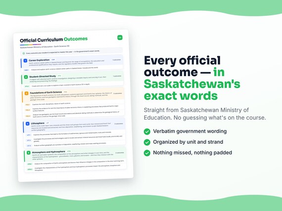
Saskatchewan defines Earth Science 30 by strands and outcomes. MapleMind teaches the same curriculum reorganized for one-skill-at-a-time tutoring — the table shows exactly where every official strand lands, and the ministry's own wording is quoted under each unit below.
Official source Saskatchewan's official curriculumRead it on the government site — curriculum.gov.sk.ca ↗| Official strand | Outcomes | Where MapleMind teaches it |
|---|---|---|
| Strand CE | 1 | Career Exploration |
| SDS | 1 | Student-Directed Study |
| Strand FO | 3 | Foundations of Earth Science |
| Strand LS | 3 | Lithosphere |
| Strand AH | 2 | Atmosphere and Hydrosphere |
Every skill below, taught one on one.
 Try the first session free
How MapleMind teaches Earth Science 30 — every unit, lesson, and skill
Every skill below runs as a short session: a plain-words lesson, a worked example, solving it together, then a five-question skill check that earns up to three stars. Guided Mode keeps it teaching instead of answer-handing — turning it off needs a parent's password.
Unit 1Career ExplorationOfficial strand · Strand CE
Earth-science career paths in Saskatchewan and beyond: the range of occupations, the education and professional qualifications they require, and the regulatory bodies that govern the field.
Earth-Science Careers
- Earth-science career paths and qualificationsES30-CE1 — Explore earth-science occupations in Saskatchewan and beyond, their roles and educational qualifications, and the regulatory bodies that govern the profession.
The official wording — 1 outcome in this unit
- ES30-CE1
Analyze and explore earth-science related career paths in Saskatchewan, Canada and the world.
Unit 2Student-Directed StudyOfficial strand · SDS
A staged, self-directed earth-science investigation: designing a testable inquiry and carrying it out, then analysing and presenting the findings.
Student-Directed Study Project
- Designing the investigationES30-SDS1 — Design a scientific investigation on an Earth Science 30 topic with a testable question, hypothesis, and experimental design.
- Carrying out and analysingES30-SDS1 — Carry out the investigation following scientific protocols, including any field experience, and analyse and interpret the data.
- Presenting and reflectingES30-SDS1 — Assemble and reflect on a portfolio and share the results of the study through a display, presentation, or demonstration.
The official wording — 1 outcome in this unit
- ES30-SDS1
Create and carry out a plan to explore a topic covered in Earth Science 30 in depth.
Unit 3Foundations of Earth ScienceOfficial strand · Strand FO
The big picture of earth science: its multi-disciplinary systems approach and Earth's four spheres, the theory of plate tectonics, and how geologists read Earth's history through the fossil record, dating methods, and the geologic time scale.
The Nature of Earth Science
- Earth's spheres and their interactionsES30-FO1 — Differentiate Earth's four spheres and explain why earth scientists study interactions between them.
- The multi-disciplinary, systems approachES30-FO1 — Explain why earth scientists use a systems approach and draw on multiple scientific disciplines, including First Nations and Metis observations.
Plate Tectonics
- Evidence for continental drift and plate tectonicsES30-FO2 — Explain the principles and driving forces of plate tectonics and the evidence, including continental drift, that supports it.
- Plate boundaries and Earth's surface featuresES30-FO2 — Describe the geological features formed at convergent, divergent, and transform boundaries and correlate them with earthquakes and volcanoes.
- Measuring and predicting plate motionES30-FO2 — Analyze satellite and GPS data to determine plate-motion rates and predict future plate boundaries.
Geologic Time and Dating
- The fossil record and the geologic time scaleES30-FO3 — Explain how the fossil record and the shift from catastrophism to uniformitarianism inform the geologic time scale.
- Relative and absolute dating methodsES30-FO3 — Contrast relative and absolute dating principles and describe how radiometric dating determines the age of rocks.
- Catastrophic events and the fossil recordES30-FO3 — Research the consequences of catastrophic events such as asteroid impacts, glaciation, and volcanism on the fossil record and geologic history.
The official wording — 3 outcomes in this unit
- ES30-FO1
Examine the multi-disciplinary nature of earth science.
- ES30-FO2
Examine the evidence for and the importance of plate tectonics theory in explaining processes that produced Earth’s major surface features.
- ES30-FO3
Analyze how geologists use the fossil record and relative and absolute dating methods to determine the geological history of Earth and to construct the geologic time scale.
Unit 4LithosphereOfficial strand · Strand LS
Earth's rocky outer layer: how minerals and the three rock groups form and cycle, how mineral and fossil-fuel resources are located and extracted, and how deposition, weathering, and erosion sculpt Saskatchewan's surface geography.
Minerals and Rock Formation
- Minerals and their identificationES30-LS1 — Identify what makes an Earth material a mineral and classify mineral samples by standard physical properties.
- The three rock groups and the rock cycleES30-LS1 — Differentiate igneous, sedimentary, and metamorphic rocks by their formation and outline the rock cycle.
- Weathering, erosion, and depositional environmentsES30-LS1 — Describe how weathering, erosion, and deposition form sedimentary rocks and compare continental, marine, and transitional depositional environments.
Mineral and Fossil-Fuel Resources
- Locating mineral and fossil-fuel resourcesES30-LS2 — Explain how depositional setting, geologic history, and imaging and seismic technologies are used to locate resources in Saskatchewan and globally.
- Resource extraction and its impactsES30-LS2 — Explain surface and sub-surface extraction technologies, their engineering challenges, and their environmental and treaty-related impacts.
- Geophysical surveys and sub-surface anomaliesES30-LS2 — Contrast geophysical imaging methods and interpret anomalies from surveys and geologic maps to identify resource deposits.
Surface Geography of Saskatchewan
- Landforms and the processes that shape themES30-LS3 — Explain how deposition, weathering, erosion, mass wasting, and glaciation produce Saskatchewan's landforms.
- Mapping and monitoring surface geographyES30-LS3 — Apply mapping techniques - topographic profiles, satellite and drone data, and GIS - to interpret and monitor surface geography.
The official wording — 3 outcomes in this unit
- ES30-LS1
Examine the processes that lead to the formation of sedimentary, igneous and metamorphic rocks and minerals.
- ES30-LS2
Investigate the processes and technologies used to locate and extract mineral resources and fossil fuels locally, provincially and globally.
- ES30-LS3
Analyze surface geography as a product of deposition, weathering, erosion and mass wasting processes.
Unit 5Atmosphere and HydrosphereOfficial strand · Strand AH
Earth's air and water systems: the composition of the atmosphere and what changes it over time, and the characteristics of the hydrosphere - groundwater, rivers, glaciers, and oceans - and how they interact with the other spheres.
Earth's Atmosphere
- Composition and history of the atmosphereES30-AH1 — Analyze the composition of Earth's atmosphere and how it originated and changed over geologic time.
- Weather, climate data, and extreme eventsES30-AH1 — Investigate the technologies and archived data used to study weather and climate, including extreme events and El Nino and La Nina in Saskatchewan.
- Reading ancient climates from proxiesES30-AH1 — Explain how earth scientists use proxies such as ice composition, tree growth, and sedimentary content to infer past climates and notable climatic events.
Earth's Hydrosphere
- Groundwater and its movementES30-AH2 — Investigate the distribution of the hydrosphere and how porosity and permeability control groundwater storage and movement.
- Rivers, glaciers, and surface water processesES30-AH2 — Explain how rivers and glaciers erode, transport, and deposit material and their role in the hydrologic cycle and climate.
- Oceans, currents, and climateES30-AH2 — Explain how ocean heat storage, currents, and thermohaline circulation moderate climate and how climate change affects the oceans.
The official wording — 2 outcomes in this unit
- ES30-AH1
Analyze the composition of Earth’s atmosphere and factors that influence changes in the composition in the short and long term.
- ES30-AH2
Investigate the characteristics of the hydrosphere and how hydrospheric processes impact the atmosphere, biosphere and lithosphere.
Printable workbook · A keepsake of the year
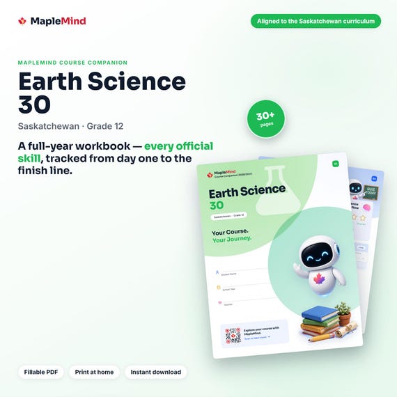
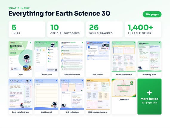
A Earth Science 30 workbook worth keeping
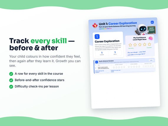
Built from the same official curriculum as this page. Before and after each skill above, your student colours in how sure they feel — so the two of you can see, on one page, what's clicking and what needs another look. It's a quiet way to follow how the year is really going.
By June it's full of their own handwriting: units worked through, confidence grown, a mid-year check-in, notes from parent-teacher night, and a certificate at the end. Less a worksheet, more a record of the year worth keeping on the shelf.
Instant download · see every page, reviews and the full description · five or more workbooks are $2.99 each
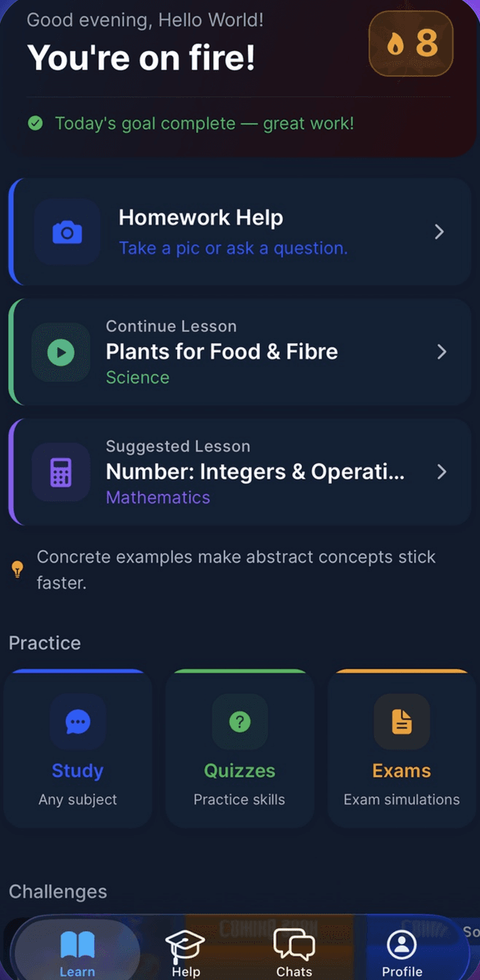
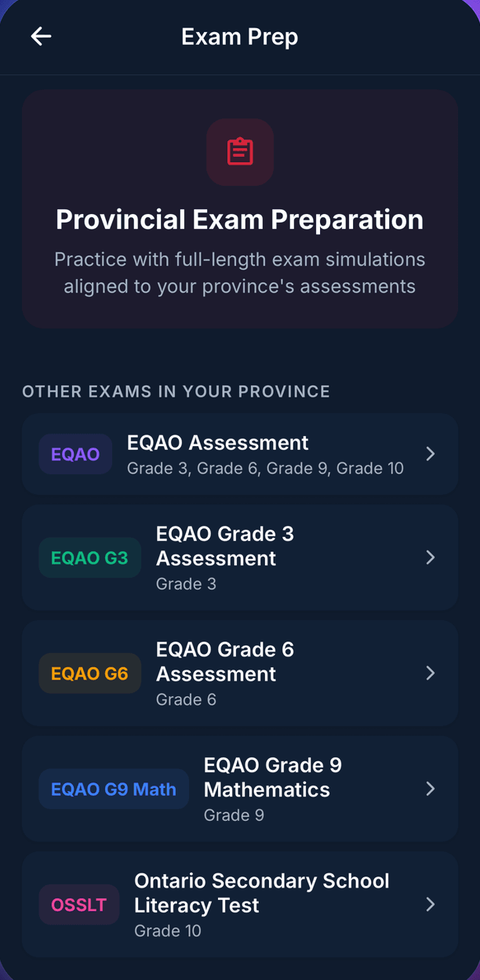
What it looks like in the app

Common questions
Can MapleMind help me with Earth Science 30?
Yes. MapleMind's AI tutor covers all 26 skills in Saskatchewan's Earth Science 30 — you pick the exact skill, and the tutor teaches it step by step: a short lesson, a worked example, solving together, then a skill check to show it stuck.
Is MapleMind aligned to Saskatchewan's official curriculum?
Yes. Every skill in this course maps to an official outcome code from Saskatchewan's Grade 12 Science curriculum, and the ministry's own wording is quoted under each unit on this page — with the official government source linked so you can check it yourself.
What does MapleMind cost?
It's free to start — 5 tutoring chats and a practice quiz every day, no credit card. A Pro subscription ($9.99/month or $49.99/year CAD, 7-day free trial) unlocks unlimited tutoring, practice, and exam simulations.
What if I'm stuck on just one topic?
That's the point of skill-level tutoring: open Earth Science 30 in the app, tap the exact skill from the list on this page, and the tutor teaches just that — no wading through lessons you don't need.
Does MapleMind work in French or other languages?
Yes — 14 languages, including French. Both the app and the tutor's explanations switch to the language you choose.
Where can I see the official Saskatchewan curriculum for Earth Science 30?
The official source is linked on this page — Saskatchewan's official curriculum. The outline here follows it: every MapleMind skill carries its official outcome code, and the ministry's own wording is quoted under each unit.
Keep exploring
Ready when you are
Pick a skill from this page and see it taught properly — free, in the browser, in under a minute.