

Get help with Geography 10
Most tutoring makes you sit through material you already know. MapleMind flips that: pick the exact skill that's causing trouble — any of the 26 below — and the tutor teaches just that one, step by step, as many times as it takes. Ask questions in plain words, any time of day, in English, French, or 12 other languages.
The official Nova Scotia Geography 10 curriculum
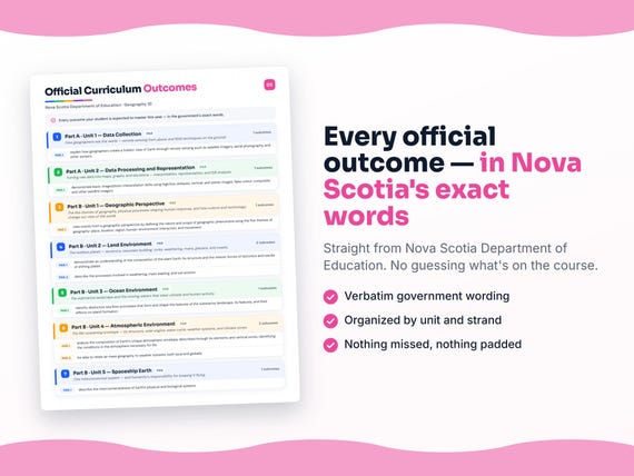
Nova Scotia defines Geography 10 by strands and outcomes. MapleMind teaches the same curriculum reorganized for one-skill-at-a-time tutoring — the table shows exactly where every official strand lands, and the ministry's own wording is quoted under each unit below.
Official source Nova Scotia's official curriculumRead it on the government site — curriculum.novascotia.ca ↗| Official strand | Outcomes | Where MapleMind teaches it |
|---|---|---|
| Strand A1 | 2 | Part A · Unit 1 — Data Collection |
| Strand A2 | 4 | Part A · Unit 2 — Data Processing and Representation |
| Strand B1 | 3 | Part B · Unit 1 — Geographic Perspective |
| Strand B2 | 8 | Part B · Unit 2 — Land Environment |
| Strand B3 | 2 | Part B · Unit 3 — Ocean Environment |
| Strand B4 | 5 | Part B · Unit 4 — Atmospheric Environment |
| Strand B5 | 2 | Part B · Unit 5 — Spaceship Earth |
Every skill below, taught one on one.
 Try the first session free
How MapleMind teaches Geography 10 — every unit, lesson, and skill
Every skill below runs as a short session: a plain-words lesson, a worked example, solving it together, then a five-question skill check that earns up to three stars. Guided Mode keeps it teaching instead of answer-handing — turning it off needs a parent's password.
Unit 1Part A · Unit 1 — Data CollectionOfficial strand · Strand A1
How geographers see the world — remote sensing from above and field techniques on the ground.
Collecting Geographic Data
- Remote sensing — the view from aboveGEO10-1.1 — Explain how geographers build a holistic view of Earth through remote sensing — satellite imagery, aerial photography, and other sensors.
- Field techniques — geography on the groundGEO10-1.2 — Explain how geographers use field techniques — surveying the landscape, sampling it, and recording land use.
The official wording — 2 outcomes in this unit
- GEO10-1.1
explain how geographers create a holistic view of Earth through remote sensing such as satellite imagery, aerial photography, and other sensors
- GEO10-1.2
explain how geographers use field techniques such as surveying landscape, sampling the landscape, and recording the land use
Unit 2Part A · Unit 2 — Data Processing and RepresentationOfficial strand · Strand A2
Turning raw data into maps, graphs, and decisions — interpretation, representation, and GIS analysis.
Interpreting Images and Choosing Maps
- Reading aerial and satellite imagesGEO10-2.1 — Demonstrate basic image and photo interpretation skills — high and low obliques, vertical and stereo images, false colour composites, and other satellite imagery.
- Choosing and using the right mapGEO10-2.2 — Select an appropriate map style — topographic, geologic, thematic — and use it to gather, organize, and display information in sketch or model form.
- Organizing quantitative dataGEO10-2.3 — Organize and interpret quantitative data in graph, chart, and table form.
- Comparative mapping and GISGEO10-3.1 — Analyze geographic information using comparative mapping techniques and geographic information systems to recognize patterns and make decisions.
The official wording — 4 outcomes in this unit
- GEO10-2.1
demonstrate basic image/photo interpretation skills using high/low obliques, vertical, and stereo images, false colour composite, and other satellite imagery
- GEO10-2.2
select an appropriate map style (topographic, geologic, thematic, etc.) and use it to gather, organize, and display information in sketch or model form
- GEO10-2.3
organize and interpret quantitative data in graph, chart, and table form
- GEO10-3.1
analyze geographic information using comparative mapping techniques and strategies and geographic information systems to recognize patterns
Unit 3Part B · Unit 1 — Geographic PerspectiveOfficial strand · Strand B1
The five themes of geography, physical processes shaping human response, and how culture and technology change our view of the world.
Thinking Geographically
- The five themes of geographyGEO10-4.1 — View events from a geographic perspective using the five themes — place, location, region, human-environment interaction, and movement.
- Physical processes and human responseGEO10-4.2 — Show how long-term and short-term physical processes influence the landscape, and how humans respond and adapt to them.
- Culture, experience, and technology shape the viewGEO10-4.3 — Show awareness of how changing perspectives of the world are dictated by culture, experience, and the impact of technology.
The official wording — 3 outcomes in this unit
- GEO10-4.1
view events from a geographic perspective by defining the nature and scope of geographic phenomena using the five themes of geography: place, location, region, human-environment interaction, and movement
- GEO10-4.2
demonstrate an understanding of how long-term and short-term physical processes influence the landscape and the human response and adaptation to these processes
- GEO10-4.3
demonstrate an awareness of how changing perspectives of the world are dictated by culture, experience, and the impact of technology
Unit 4Part B · Unit 2 — Land EnvironmentOfficial strand · Strand B2
The restless planet — tectonics, mountain building, rocks, weathering, rivers, glaciers, and coasts.
The Planet in Motion
- Earth's structure and plate tectonicsGEO10-5.1 — Show understanding of Earth's composition and structure, and the interior tectonic forces and shifting plates that shaped the planet's features.
- The changing face of EarthGEO10-5.2 — Show knowledge of the changing face of Earth's surface and the forces that keep Earth in motion.
- Earth movements and mountain buildingGEO10-5.3 — Show understanding of the interior forces associated with diastrophism, earth movements, and mountain building.
- Rock-building, classification, and usesGEO10-5.4 — Recognize and explain the forces generating rock-building processes, classify rocks and minerals, and describe rocks' uses in daily life.
Wearing Down the Land
- Weathering, mass wasting, and soil erosionGEO10-5.5 — Describe the processes involved in weathering, mass wasting, and soil erosion.
- Rivers and their landscapesGEO10-5.6 — Recognize and describe river features and the effects of rivers on human and physical landscapes.
- Glacial processes and their imprintGEO10-5.7 — Show understanding of glacial processes and their impact on the physical environment.
- Coastal landscapes and human interactionGEO10-5.8 — Show understanding of coastal features shaped by wave action, and the implications for human-environment interaction.
The official wording — 8 outcomes in this unit
- GEO10-5.1
demonstrate an understanding of the composition of the plant Earth, its structure and the interior forces of tectonics and results of shifting plates
- GEO10-5.2
demonstrate knowledge of the changing face of Earth’s surface and of the forces that keep Earth in motion
- GEO10-5.3
demonstrate an understanding of the interior forces associated with diastrophism, earth movements, and mountain building
- GEO10-5.4
recognize and explain the forces generating rock-building processes, classify rocks and minerals, and describe the uses of rocks in the daily lives of humans
- GEO10-5.5
describe the processes involved in weathering, mass wasting, and soil erosion
- GEO10-5.6
recognize and describe the features associated with rivers, and the effects of rivers on human and physical landscapes
- GEO10-5.7
demonstrate an understanding of glacial processes and the subsequent impact on the physical environment
- GEO10-5.8
demonstrate an understanding of coastal landscape features shaped through the action of waves, and the implications for human-environment interaction
Unit 5Part B · Unit 3 — Ocean EnvironmentOfficial strand · Strand B3
The submarine landscape and the moving waters that steer climate and human activity.
The Working Ocean
- Sea floor processes and submarine featuresGEO10-6.1 — Identify the sea floor processes that form and shape the submarine landscape, its features, and their effects on island formation.
- Moving waters, climate, and human activityGEO10-6.2 — Assess the effects of the ocean's moving waters on Earth's atmosphere and on human activity.
The official wording — 2 outcomes in this unit
- GEO10-6.1
identify distinctive sea floor processes that form and shape the features of the submarine landscape, its features, and their effects on island formation
- GEO10-6.2
assess the effects of the ocean’s moving waters on the atmosphere of Earth and upon human activity
Unit 6Part B · Unit 4 — Atmospheric EnvironmentOfficial strand · Strand B4
The life-sustaining envelope — its structure, solar engine, water cycle, weather systems, and climate zones.
The Atmosphere's Engine
- The atmosphere's composition and zonesGEO10-7.1 — Analyze the composition of Earth's atmospheric envelope — its elements and vertical zones — and the conditions necessary for life.
- The sun-driven systemsGEO10-7.2 — Show understanding of the complex systems resulting from the energy released from the sun.
- The hydrosphere and precipitationGEO10-7.3 — Show knowledge of the hydrosphere's complexity — the hydrologic cycle and the types and modes of precipitation.
Weather Systems and Climate Zones
- Air masses and weather systemsGEO10-7.4 — Relate air mass geography to weather systems, locally and globally.
- Climate data and world zonesGEO10-7.5 — Use climatic data to identify the major climatic zones of the world.
The official wording — 5 outcomes in this unit
- GEO10-7.1
analyze the composition of Earth’s unique atmospheric envelope, described through its elements and vertical zones, identifying the conditions in the atmosphere necessary for life
- GEO10-7.2
demonstrate an understanding of the complex systems resulting from the energy released from the sun
- GEO10-7.3
demonstrate a knowledge of the complexity of the hydrosphere as it applies to the hydrologic cycle and subsequent types/modes of precipitation
- GEO10-7.4
be able to relate air mass geography to weather systems, both local and globally
- GEO10-7.5
use climatic data to identify major climatic zones of the world
Unit 7Part B · Unit 5 — Spaceship EarthOfficial strand · Strand B5
One interconnected system — and humanity's responsibility for keeping it flying.
One Connected System
- Earth's interconnected systemsGEO10-8.1 — Describe the interconnectedness of Earth's physical and biological systems.
- Humanity in the web — sustainabilityGEO10-8.2 — Show understanding that humanity is part of the planet's physical-biological web, and that sustainability depends on wise planet management and global co-operation.
The official wording — 2 outcomes in this unit
- GEO10-8.1
describe the interconnectedness of Earth’s physical and biological systems
- GEO10-8.2
demonstrate an understanding that humanity is part of the planet’s physical-biological web, and that sustainability is dependent upon wise planet management systems and global co-operation
Printable workbook · A keepsake of the year
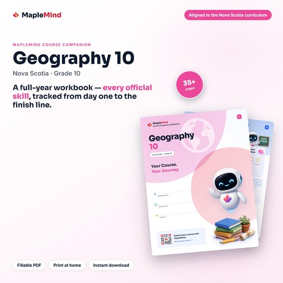
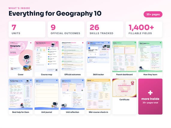
A Geography 10 workbook worth keeping
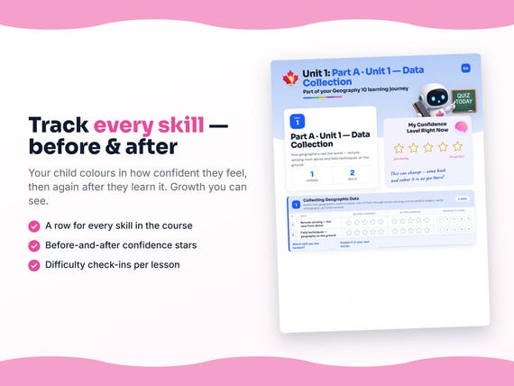
Built from the same official curriculum as this page. Before and after each skill above, your student colours in how sure they feel — so the two of you can see, on one page, what's clicking and what needs another look. It's a quiet way to follow how the year is really going.
By June it's full of their own handwriting: units worked through, confidence grown, a mid-year check-in, notes from parent-teacher night, and a certificate at the end. Less a worksheet, more a record of the year worth keeping on the shelf.
Instant download · see every page, reviews and the full description · five or more workbooks are $2.99 each
What it looks like in the app
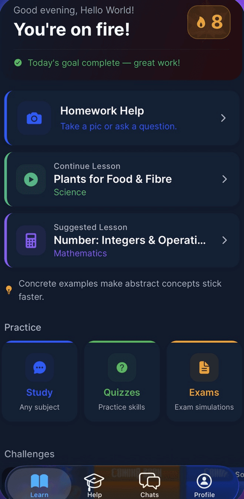
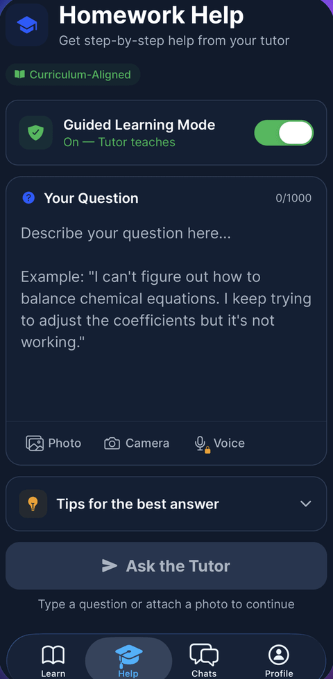
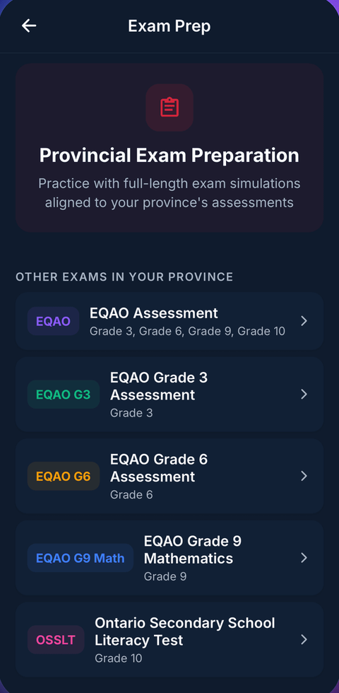
Common questions
Can MapleMind help me with Geography 10?
Yes. MapleMind's AI tutor covers all 26 skills in Nova Scotia's Geography 10 — you pick the exact skill, and the tutor teaches it step by step: a short lesson, a worked example, solving together, then a skill check to show it stuck.
Is MapleMind aligned to Nova Scotia's official curriculum?
Yes. Every skill in this course maps to an official outcome code from Nova Scotia's Grade 10 Social Studies curriculum, and the ministry's own wording is quoted under each unit on this page — with the official government source linked so you can check it yourself.
What does MapleMind cost?
It's free to start — 5 tutoring chats and a practice quiz every day, no credit card. A Pro subscription ($9.99/month or $49.99/year CAD, 7-day free trial) unlocks unlimited tutoring, practice, and exam simulations.
What if I'm stuck on just one topic?
That's the point of skill-level tutoring: open Geography 10 in the app, tap the exact skill from the list on this page, and the tutor teaches just that — no wading through lessons you don't need.
Does MapleMind work in French or other languages?
Yes — 14 languages, including French. Both the app and the tutor's explanations switch to the language you choose.
Where can I see the official Nova Scotia curriculum for Geography 10?
The official source is linked on this page — Nova Scotia's official curriculum. The outline here follows it: every MapleMind skill carries its official outcome code, and the ministry's own wording is quoted under each unit.
Keep exploring
Ready when you are
Pick a skill from this page and see it taught properly — free, in the browser, in under a minute.