Get help with Geography, Secondary Cycle One (Secondary 1-2)
Most tutoring makes you sit through material you already know. MapleMind flips that: pick the exact skill that's causing trouble — any of the 40 below — and the tutor teaches just that one, step by step, as many times as it takes. Ask questions in plain words, any time of day, in English, French, or 12 other languages.
The official Quebec Geography, Secondary Cycle One (Secondary 1-2) curriculum
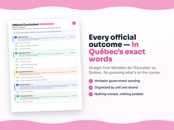
Quebec defines Geography, Secondary Cycle One (Secondary 1-2) by strands and outcomes. MapleMind teaches the same curriculum reorganized for one-skill-at-a-time tutoring — the table shows exactly where every official strand lands, and the ministry's own wording is quoted under each unit below.
Official source Québec's official education programRead it on the government site — quebec.ca ↗| Official strand | Outcomes | Where MapleMind teaches it |
|---|---|---|
| GEO | 40 | Urban territory · Regional territory · Agricultural territory · Native territory · Protected territory · Techniques used in geography |
Every skill below, taught one on one.
 Try the first session free
How MapleMind teaches Geography, Secondary Cycle One (Secondary 1-2) — every unit, lesson, and skill
Every skill below runs as a short session: a plain-words lesson, a worked example, solving it together, then a five-question skill check that earns up to three stars. Guided Mode keeps it teaching instead of answer-handing — turning it off needs a parent's password.
Unit 1Urban territoryOfficial strand · GEO
Cities as territories: the metropolis, the city living with natural hazards, and the heritage city - how each is located, organized, developed, and challenged.
The Metropolis
- Situating and characterizing a metropolisGEO.001 — Locate a metropolis and describe its site, population, and the concentration of power and services that define it.
- Planning and developing a metropolisGEO.012 — Describe how a metropolis is planned and developed - its neighbourhoods, suburbs, infrastructure, and the strains of urban sprawl.
- Issues facing a metropolisGEO.019 — Analyze the issues a metropolis faces - housing, transport, waste, and water - and the measures taken to address them.
A City and Natural Hazards
- Situating a city subject to natural hazardsGEO.032 — Locate a city subject to natural hazards and explain the hazard it faces and why people live there despite the risk.
- Planning a city for natural hazardsGEO.041 — Describe how a city subject to natural hazards is planned to protect its residents.
- When a hazard becomes a disasterGEO.045 — Analyze how a natural hazard can turn into a disaster and how urbanization and development shape its consequences.
The Heritage City
- Situating and characterizing a heritage cityGEO.050 — Locate a heritage city and describe its heritage site and how it comes to be recognized.
- Protecting and accessing a heritage siteGEO.060 — Describe how a heritage city is planned - protecting the site while providing access and meeting residents' needs.
- Protecting heritage under pressureGEO.064 — Analyze the pressures on heritage cities - degradation and mass tourism - and the constraints and limits of protection.
The official wording — 9 outcomes in this unit
- GEO.001
Location of a metropolis
- GEO.012
Planning and development of a metropolis
- GEO.019
Issues affecting a metropolis or metropolises
- GEO.032
Location of a city subject to natural hazards
- GEO.041
Planning and development of a city subject to natural hazards
- GEO.045
Issues affecting a city or cities subject to natural hazards
- GEO.050
Location of a heritage city
- GEO.060
Planning and development of a heritage city
- GEO.064
Issues affecting a heritage city or cities
Unit 2Regional territoryOfficial strand · GEO
Regions defined by an activity: tourism, forestry, energy, and industry - how each region is located, characterized, developed, and challenged.
The Tourist Region
- Situating and characterizing a tourist regionGEO.071 — Locate a tourist region and describe the attractions and tourist flows that define it.
- Developing a tourist regionGEO.080 — Describe how a tourist region is developed to receive and move its visitors.
- The two faces of tourismGEO.084 — Analyze how tourism both changes and threatens a region, and the measures taken to protect it.
The Forest Region
- Situating and characterizing a forest regionGEO.089 — Locate a forest region and describe the forest it exploits and how.
- From forest to marketGEO.100 — Describe how the forest resource is commercialized - the industries, transport, and infrastructure that bring wood to market.
- Exhausting or renewing the forestGEO.105 — Analyze the threat of over-logging and the practices that renew a forest and reconcile competing interests.
The Energy-Producing Region
- Situating and characterizing an energy regionGEO.111 — Locate an energy-producing region and describe the energy it develops and why.
- Producing and transporting energyGEO.120 — Describe how an energy region exploits, processes, and transports its energy resource.
- The cost of energyGEO.125 — Analyze the environmental consequences of energy production and rising consumption, and the measures taken in response.
The Industrial Region
- Situating and characterizing an industrial regionGEO.132 — Locate an industrial region and explain why industry concentrates there.
- Developing an industrial regionGEO.142 — Describe how an industrial region is developed and the constraints and effects that come with it.
- Pollution, decline, and relocationGEO.147 — Analyze the environmental impact of industry and the hardship of industrial decline and relocation.
The official wording — 12 outcomes in this unit
- GEO.071
Location of a tourist region
- GEO.080
Planning and development of a tourist region
- GEO.084
Issue affecting a tourist region or regions
- GEO.089
Location of a forest region
- GEO.100
Planning and development of a forest region
- GEO.105
Issue affecting a forest region or regions
- GEO.111
Location of an energy-producing region
- GEO.120
Planning and development of an energy-producing region
- GEO.125
Issue affecting an energy-producing region or regions
- GEO.132
Location of an industrial region
- GEO.142
Planning and development of an industrial region
- GEO.147
Issue affecting an industrial region or regions
Unit 3Agricultural territoryOfficial strand · GEO
Farmland as territory: an agricultural territory in a national space and one subject to natural hazards - how each feeds people, is developed, and is threatened.
An Agricultural Territory
- Situating and characterizing an agricultural territoryGEO.155 — Locate an agricultural territory and describe its crops, land, and the factors that shape farming there.
- Farming practices and productivityGEO.165 — Describe the farming practices and infrastructure used to make an agricultural territory productive.
- Farming and its impactsGEO.169 — Analyze the environmental and social issues of farming and the measures taken to address them.
Farming and Natural Hazards
- Farmland in a hazard zoneGEO.176 — Locate an agricultural territory subject to natural hazards and describe the hazards and farming there.
- Protecting hazard-prone farmlandGEO.185 — Describe how an agricultural territory subject to natural hazards is developed and protected.
- When people intensify the riskGEO.190 — Analyze how human actions can intensify or create risk on hazard-prone farmland, and the solutions taken.
The official wording — 6 outcomes in this unit
- GEO.155
Location of an agricultural territory in a national space
- GEO.165
Planning and development of an agricultural territory in a national space
- GEO.169
Issues affecting an agricultural territory or territories in a national space
- GEO.176
Location of an agricultural territory subject to natural hazards
- GEO.185
Planning and development of an agricultural territory subject to natural hazards
- GEO.190
Issues affecting an agricultural territory or territories subject to natural hazards
Unit 4Native territoryOfficial strand · GEO
First Nations and Inuit territories: their location, cultures, ancestral rights, self-governance and the agreements with the government of Quebec, how they are organized and developed, and the claims still to be resolved. Taught truthfully and respectfully as real governance and land questions.
First Nations and Inuit Territories
- First Nations and Inuit territories and culturesGEO.197 — Locate First Nations and Inuit territories and name elements of their living cultures.
- Ancestral rights, agreements, and self-governanceGEO.200 — Explain the ancestral rights of First Nations and Inuit peoples, the agreements with the government of Quebec, and how these territories govern themselves.
- Organizing and developing the territoryGEO.208 — Describe how First Nations and Inuit territories are organized and developed, and the constraints of the northern environment.
The official wording — 4 outcomes in this unit
- GEO.197
Location of a Native territory
- GEO.200
Characteristics of a Native territory
- GEO.208
Planning and development of a Native territory
- GEO.213
Issue affecting a Native territory or territories
Unit 5Protected territoryOfficial strand · GEO
The natural park as a protected territory: how it is located, what it protects, how it is zoned and developed, and the tension between conservation and use.
The Natural Park
- Situating and characterizing a natural parkGEO.219 — Locate a natural park and describe what it protects and why it was created.
- Zoning and developing a parkGEO.228 — Describe how a natural park is zoned and developed to protect it while receiving visitors.
- Conservation versus useGEO.232 — Analyze the tension between conserving a natural park and allowing people to use it.
The official wording — 3 outcomes in this unit
- GEO.219
Location of a natural park
- GEO.228
Planning and development of a natural park
- GEO.232
Issue affecting a natural park or parks
Unit 6Techniques used in geographyOfficial strand · GEO
The geographer's toolkit: sketching and drawing maps, interpreting maps and documents, and working with tables and graphs. Method skills taught in their own right, woven through the territory studies.
Sketching and Drawing Maps
- Reading and sketching a landscapeGEO.238 — Interpret a landscape and draw a geographic sketch of it with its essential elements, legend, and title.
- Drawing a simple mapGEO.252 — Draw a simple map with a purpose, selecting the essential elements and giving it a legend, scale, and title.
Interpreting Maps and Documents
- Interpreting a mapGEO.262 — Interpret a map using its title, scale, orientation, legend, and the spatial patterns it shows.
- Interpreting written and illustrated documentsGEO.269 — Interpret written and illustrated documents by checking their source, nature, and main ideas.
Working with Tables and Graphs
- Interpreting a table and graphGEO.284 — Interpret a table and graph using its title, legend, and scale to find the data you need.
- Constructing a table and graphGEO.290 — Construct a table and graph with its purpose, entries, scale, legend, data, and title.
The official wording — 6 outcomes in this unit
- GEO.238
requiring the interpretation of maps, the use of written documents, tables or graphs
- GEO.252
Draws a simple map
- GEO.262
Interprets a map
- GEO.269
Interprets a written document
- GEO.284
Interprets a table and graph
- GEO.290
Constructs a table and graph
Printable workbook · A keepsake of the year
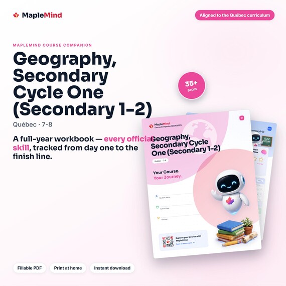
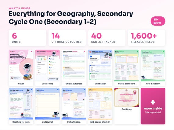
A Geography, Secondary Cycle One (Secondary 1-2) workbook worth keeping
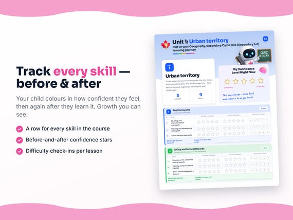
Built from the same official curriculum as this page. Before and after each skill above, your student colours in how sure they feel — so the two of you can see, on one page, what's clicking and what needs another look. It's a quiet way to follow how the year is really going.
By June it's full of their own handwriting: units worked through, confidence grown, a mid-year check-in, notes from parent-teacher night, and a certificate at the end. Less a worksheet, more a record of the year worth keeping on the shelf.
Instant download · see every page, reviews and the full description · five or more workbooks are $2.99 each
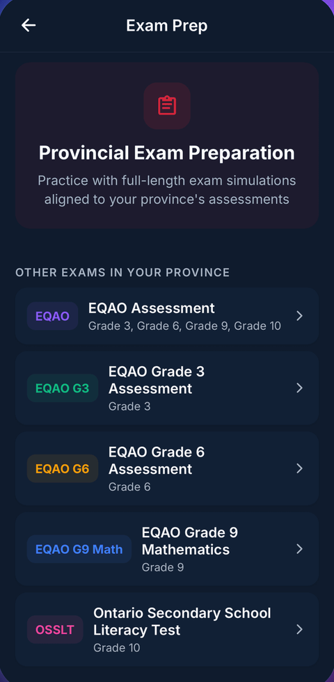
What it looks like in the app


Common questions
Can MapleMind help me with Geography, Secondary Cycle One (Secondary 1-2)?
Yes. MapleMind's AI tutor covers all 40 skills in Quebec's Geography, Secondary Cycle One (Secondary 1-2) — you pick the exact skill, and the tutor teaches it step by step: a short lesson, a worked example, solving together, then a skill check to show it stuck.
Is MapleMind aligned to Quebec's official curriculum?
Yes. Every skill in this course maps to an official outcome code from Quebec's Grades 7–8 Social Studies curriculum, and the ministry's own wording is quoted under each unit on this page — with the official government source linked so you can check it yourself.
What does MapleMind cost?
It's free to start — 5 tutoring chats and a practice quiz every day, no credit card. A Pro subscription ($9.99/month or $49.99/year CAD, 7-day free trial) unlocks unlimited tutoring, practice, and exam simulations.
What if I'm stuck on just one topic?
That's the point of skill-level tutoring: open Geography, Secondary Cycle One (Secondary 1-2) in the app, tap the exact skill from the list on this page, and the tutor teaches just that — no wading through lessons you don't need.
Does MapleMind work in French or other languages?
Yes — 14 languages, including French. Both the app and the tutor's explanations switch to the language you choose.
Where can I see the official Quebec curriculum for Geography, Secondary Cycle One (Secondary 1-2)?
The official source is linked on this page — Québec's official education program. The outline here follows it: every MapleMind skill carries its official outcome code, and the ministry's own wording is quoted under each unit.
Ready when you are
Pick a skill from this page and see it taught properly — free, in the browser, in under a minute.